Coastal rock formations
A section for observing waves and volcanic rock shapes. Do not take risks by descending from the coastal path onto rocks.
Islands off Jeju · Islands
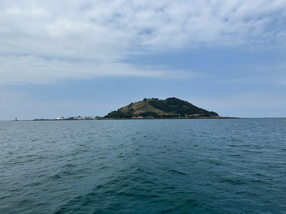
This guide covers Biyangdo off Hallim, visible from Hyeopjae Beach. It is a different island from the namesake Biyangdo beside Udo. Take a ferry from Hallim Port to walk among coastal rocks and the village, or choose views from Biyangbong and the lighthouse.
Travel planning at a glance
For Biyangdo off Hallim, check outbound and return ferries from Hallim Port first. It is different from Biyangdo beside Udo, and coastal walking and climbing Biyangbong differ in time and slope. Half a day is an editorial reference; allow extra for ferry waiting and weather, and return to the dock before the last sailing.
Biyangdo Island
Operating and access information is based on the official sources below. Recommended routes and visit durations are editorial suggestions. Check each place's description to see whether waiting, meals and similar time are included, and allow separate time for travel between places.
Biyangdo · Official information ↗ · Checked
The coastal path offers views where the sea meets volcanic rocks of different shapes, including Aegi-eobeun-dol and Elephant Rock. Rather than treating rock names only as a list of photo spots, observe waves and coastal landforms from designated paths. Shore rocks have different surfaces from the coastal road, so beware of waves and slipping.
Biyangbong adds a climb through woodland and steps for views of the island and Hallim coast from around the lighthouse. Peollangmot, where seawater flows in and out, offers wetland scenery different from the rocky shore. Prioritize around your return ferry rather than rushing through the coast, summit and village in one visit.
A section for observing waves and volcanic rock shapes. Do not take risks by descending from the coastal path onto rocks.
An itinerary with an additional ridge climb. Views toward Hallim vary with fog and wind.
Biyangdo · Official information ↗ · Checked
Check the outbound ferry from Hallim Port and your return from the island together for the same date. Do not treat an old tourism description's number of daily sailings as a fixed current timetable; use that day's operator and port guidance. Ticketing, identity checks and boarding preparations are separate from island walking time.
The coastal walk and Biyangbong summit differ in elevation and visiting time. Half a day is an editorial planning reference, not an assurance that all visitors walk at the same pace. If going to the summit, avoid spending too long on the coast and leave time for the distance back to the dock.
Biyangdo · Official information ↗ · Checked
With companions who find walking difficult, consider a coastal and village route excluding Biyangbong's steps. Do not assume a flat, stroller-accessible route covers the entire island; check actual surfaces. Before approaching seaside rocks with children, check wave height and safety boundaries.
Peollangmot and coastal wildlife are for observation: do not enter the wetland or collect rocks or living organisms. Bring an outer layer for sea winds and drinking water. Even if the island looks close to Jeju's main island, bad weather can cancel ferries, so leave flexibility before important plans after your return.
Biyangdo · Official information ↗ · Checked
Confirm Hallim Port and Biyangdo off Hallim when booking and using maps. Do not confuse the ferry and address in this guide with the namesake Biyangdo reached on foot during an Udo trip. Check actual ticketing, boarding and parking locations at the port, then leave your vehicle on Jeju's main island before crossing.
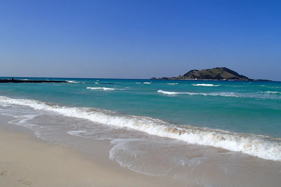
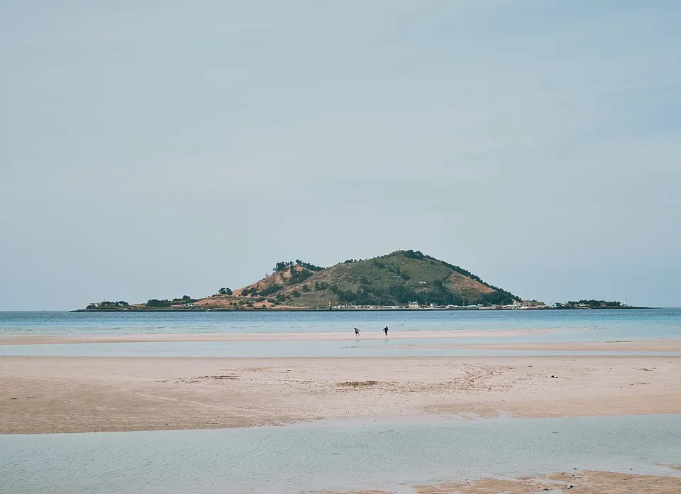
After returning, Hyeopjae and Geumneung beaches offer views of the island you just visited from Jeju's main island. Choose one beach according to your accommodation's direction and remaining stamina rather than walking both at length. Beach views can be an alternative when ferries are unavailable, but check strong winds and waves on the main-island coast separately for that day.
Island reference location · 제주특별자치도 제주시 한림읍 협재리
Biyangdo · Official information ↗ · Checked
After returning to port, consider viewing Biyangdo from Hyeopjae on Jeju's main island or taking a coastal walk.
Visitor guide →Another beach beside Hyeopjae; choose one according to your accommodation's direction and remaining time.
Visitor guide →This page covers western Biyangdo, reached by ferry from Hallim Port. It is different from the island of the same name beside Udo.
Check ferries departing from Hallim Port. Confirm that day's service, ticketing and boarding locations, and the return sailing together.
The coastal walk and the climb to Biyangbong and the lighthouse differ in distance and slope. Allow more time and energy if adding the summit.
Half a day is an editorial reference. What you can cover varies with ferries, waiting and time at the summit, so choose your route around your return sailing.